

Headrights Research
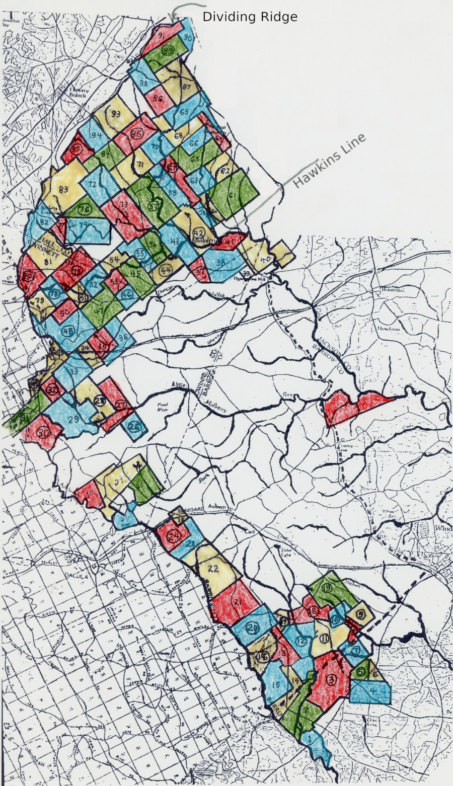
Franklin county Georgia was created in 1784. It's northwestern boundary followed a line from Currahee Mountain southwest to the headwaters of the Apalachee river near the site where Fort Daniel would later stand at Hog Mountain. From here it followed the river (also called the South Fork of the Oconee) down to Greene county. Jackson county was cut from the western half of Franklin in 1796 and in 1812 the northwest boundary was extended a few miles west to the dividing ridge. In 1818, Gwinnett, Hall, and Walton counties were formed out of the westernmost land of Jackson. To understand where an ancestor lived one must follow the land records. The 1871 fire in Gwinnett makes this nearly impossible for researchers, leaving us with the earliest records being a handful of headright grants, re-filed deeds, and a few original deeds that have survived in private collections augmented by hints in tax digests and agriculture schedules from the census.
Headright research is much akin to working a jigsaw puzzle. You have a bunch of pieces (plats), some are edges (waterways, Indian boundaries), no idea if you have all the pieces, and some might be from another puzzle that looks similar (re-granted land). Add to this that the earliest surveyors seen to have often been drunk, lost, scoundrels, or some combination of the three makes this area of research a challenge.
Presented here is an index of plats for the above mentioned counties with an emphasis on what later became Gwinnett. The index can also be found on Georgia's Virtual Vault but not the plats. The plats are my own addition from the original microfilm. The index was originally created by Mary Abbe and funded by a grant from the R. J. Taylor Foundation. I have attempted to build on this and make corrections and additions where needed.
Index of plats
A map of grants along the Apalachee river and of Hall county between the Hawkins line and the Dividing Ridge.


Panther Computers Homepage Version 5
© 1998-2018 PantherSoftware